Thursday, August 29, 2013

Three-4-Thursday


On June 7, Kathy and I hiked up the trail which leads from U.S. Highway 50 up to Boss Lake reservoir and then on to Hunt Lake.  Well, actually, we drove up a large part of the way to Boss Lake in Nelson's old Blazer (affectionately known as "The Beast").  Once the "road" became too rough to proceed any farther, we parked the truck.  Just as we were ready to start hiking, there was a sudden snow/slush/hail shower.  The snow accumulated quickly on the windshield and roof of the vehicle.  In about ten minutes, it was over and we headed up the trail.


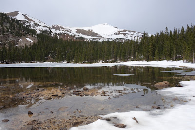
After a lot of slogging through wet snow, I made it to Hunt Lake, which has an elevation of 11,554'.  In the background is Clover Mountain, located along the Continental Divide.


With snow covering most of the trail once we passed Boss Lake, there were times when we strayed from the intended route.
  

Wednesday, August 28, 2013

Wednesday Wildlife


On June 6, I hiked the Colorado Trail from the Mt. Shavano campground south to U.S. Highway 50.  Nestled high in an aspen along the trail was this very large bird's nest.  I'm guessing it was built by a raptor.  But which one?


Thursday, August 22, 2013

Three-4-Thursday

Aragon Redux


Since I had such a great response to last Thursday's post about Mike's adventure at Aragon Rapid earlier this month, I have added three more photos of the carnage.  In the photo above, Mike approaches the key boulder, which is covered by the river.  The plan is to pass it on river right (the sneak route) or, failing that, squeeze between it and the large exposed rocks to its left (not seen in the photograph).  That second option leads one into a big hole and very large standing wave, i.e. the meat of the rapid.  The key is to avoid hitting the boulder itself, especially broadside.  Oops!


Purely for educational purposes, here is what happened.


Now if only I could locate those photos from last year showing Mike really nailing this rapid. Perhaps they can be located and used in a later post.

Note:  Click on any photo to enlarge.

This is the 200th post of my blogging career.  The first was on Mother's Day of 2008.  It's been fun, I guess.
   

Wednesday, August 21, 2013

Wednesday Wildlife


On our last day on the Rio Chama, a pair of mule deer (Odocoileus hemionus) crossed the river a short distance in front of us.  They were heading in the direction of Huckabay Canyon, a box canyon on river left.


Tuesday, August 20, 2013

Two-4-Tuesday


Two views of Chimney Rock at Ghost Ranch on the morning after my Rio Chama trip in August.  In the photo below, Lake Abiquiu can be seen in the background on the left.  Be thankful that I was not in charge of naming this interesting rock formation.


Note:  Click on a photo to enlarge.
 

Sunday, August 18, 2013

Sunday Sunlight


The setting sun illuminates a canyon wall at our camp site on the Rio Chama on August 3.
 

Thursday, August 15, 2013

Three-4-Thursday


Mike uses Aragon Rapid to teach our younger viewers the dangers of drinking and paddling.


This public service sequence occurred on the second day of our trip on the Rio Chama earlier this month.


Don't try this at home, kids.

Wednesday, August 14, 2013

Wednesday Wildlife


While trying to locate the loop trail descending from Navajo Peak to where our boats were tied off at the junction of the Rio Cebolla with the Rio Chama on May 31, I came across this male Violet-green Swallow (Tachycineta thalassina).  It fluttered out of a rocky crevice onto the ground in front of me.  I don't know whether it was injured, still in a torpor, or (perhaps most likely) trying to divert me from its nest hidden in the rocks.  In any case, it simply lay there without objecting to my presence.  As you can see, the bird's coloring was quite spectacular.


Tuesday, August 13, 2013

Two-4-Tuesday


A couple of shots from my Rio Chama trip earlier this month.  On our first day on the river, we stopped at the hot springs located at Mile 4, across the river from the remains of the old Ward Ranch cabin.  Our third day on the river was a layover day at our camp at Mile 16.  Three of us made it to the top of the canyon.  The photograph below is of the view downstream.  If you look closely (click on the photo to enlarge), you can see a few plumes of smoke from some small wildfires on the opposite side of the river.